UPDATE: Evacuation levels lowered on Lower Dry Creek Fire
By Terry Murry on Friday, July 17th, 2026 in Columbia Basin News More Top Stories
The Umatilla County Sheriff’s office reports the following for Friday at 11:30 a.m.:
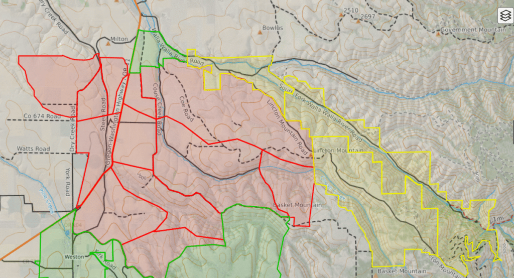
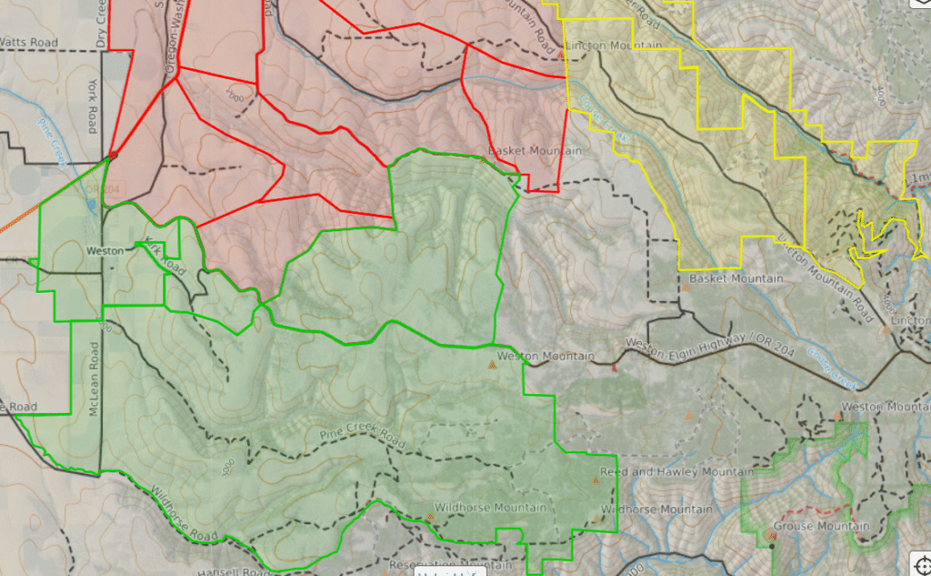
Umatilla County Sheriff’s Office remains actively engaged with Incident Command for the Lower Dry Creek Fire area. After this morning’s fire update, fire activity has significantly decreased and evacuation levels have been lowered.
Current evacuation levels in Umatilla County for the Lower Dry Creek Fire are:
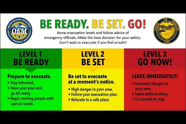
LEVEL 1 (BE READY)
UMC-151-C, UMC-151-A and WEW-115 cover the area north of Wildhorse Road, south of Highway 204, east of Schrimpf Road and DeGraw Road, and west of Weston Mountain.
MIF-073-A covers the area west of Couse Creek, east of Highway 11, south of Sykes Boulevard, and north of Alderbanks Vineyard.
UMC-117-B covers the area south of Basket Mountain Road, north of Highway 204, west of Hodgson Road, and east of Schiewe Lane.
LEVEL 2 (BE SET)
UMC-123: Includes South Fork Walla Walla River Road.
UMC-075-A: Includes Lincton Mountain Road.
UMC-077-A: Includes Walla Walla River Road and forms the northern boundary of the evacuation area.
LEVEL 3 (GO NOW!)
UMC-071-E: East of Pine Creek and south of Lower Dry Creek Road.
UMC-071-F and UMC-071-B: West of Highway 11, including Steen Road and York Road north of Highway 11.
UMC-117-C: Includes the Highway 204 and Steen Road area.
UMC-117-D: Includes Couse Creek Road.
UMC-117-E: North and east of Highway 11.
UMC-075-B: North of Basket Mountain Road.
UMC-075-C: Includes Coe Road and Cache Hollow Road.
While residents are able to return in LEVEL 1 and LEVEL 2 areas, they should remain aware of ongoing fire operations and use caution around emergency personnel and equipment.
LEVEL 3 areas will remain in effect for now, not only to ensure the safety of the public, but ensure emergency personnel on the fire can safely continue with their mission.
Couse Creek Rd remains closed until further notice.