UPDATE: Evacuation levels increased for the Hagen Fire
By Terry Murry on Friday, July 17th, 2026 in Columbia Basin News More Top Stories
UPDATE: Evacuation levels have been increased around the Hagen Fire in the Bingham Road area:
UPDATE: 07/17/2026 AT 6:00 p.m. EVACUATION LEVELS INCREASED for HAGEN FIRE
LEVEL 3 – (GO now!)
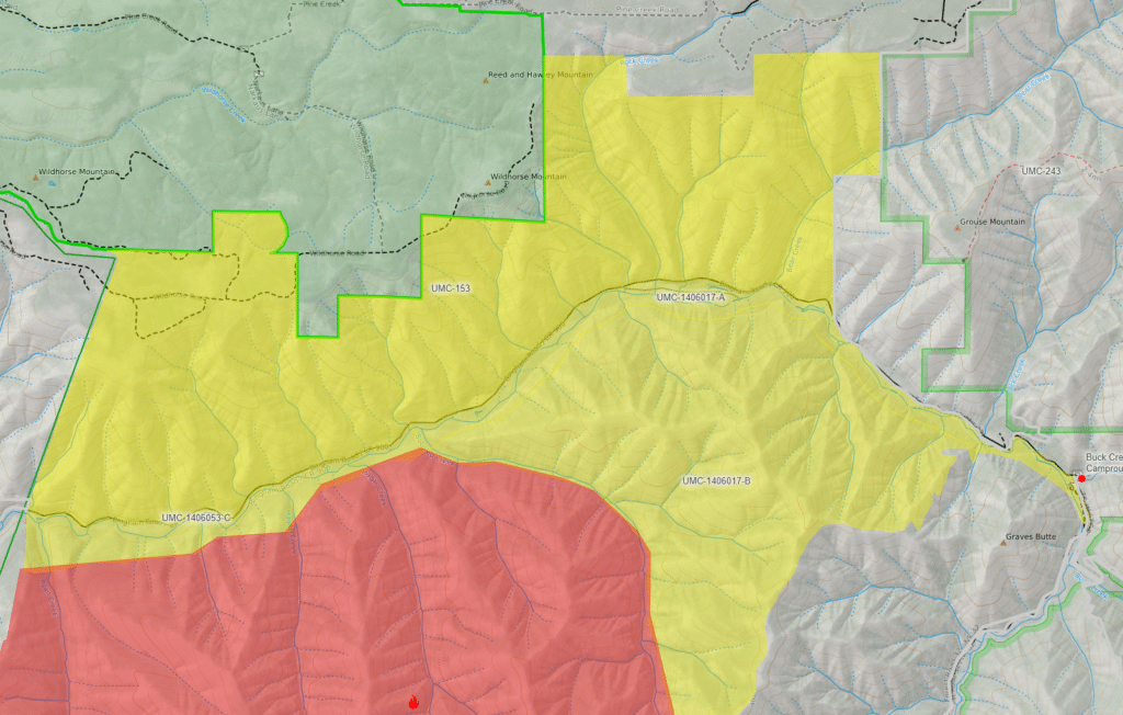
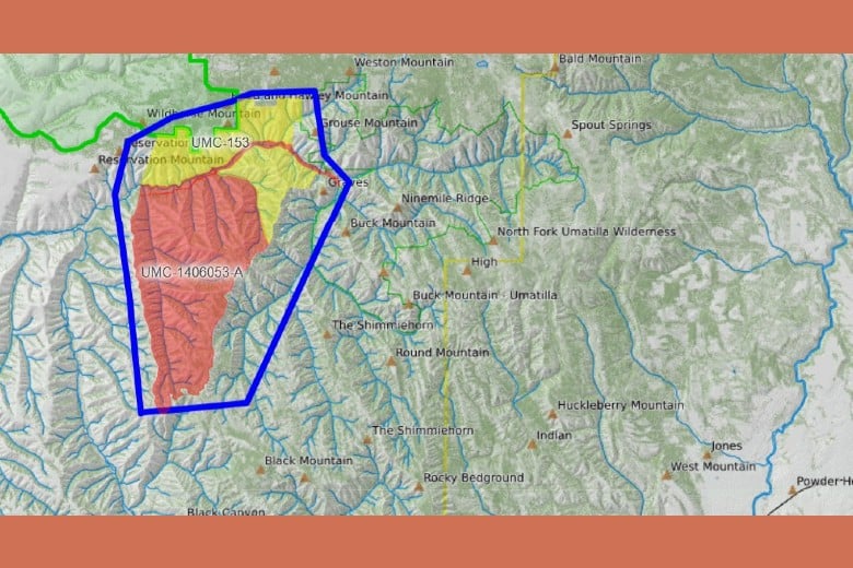
Bingham Rd and Umatilla River Corridor has been upgraded to LEVEL 3 (as reflected in the new map above)
Monitor the Umatilla County Sheriff’s Office Facebook page for most current evacuation levels.
POSTED EARLIER:
UMATILLA COUNTY – The Umatilla National Forest has reported three new fires. One of them, the Hagen Fire, has prompted the Umatilla County Emergency Preparedness Office to call for evacuations.
Umatilla County Sheriff’s Office has been monitoring the progress of a new fire (HAGEN FIRE), just south of Bingham Rd.
Effective immediately the following evacuation notices are in effect for the HAGEN FIRE:
LEVEL 2 – BE SET
Bingham Rd and Umatilla River Corridor
LEVEL 3 – GO NOW!
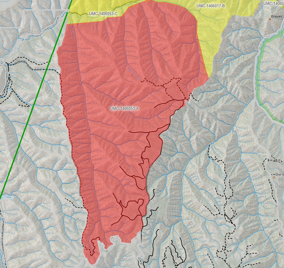
Hagen Creek area
(Map is provided above)
The following release details the three fires from the Umatilla National Forest:
Multiple lightning strikes from the past couple days across the Umatilla National Forest ignited approximately 20 fires across the forest. Some of these fires are in extended attack with numerous resources aiding fire suppression. Multiple agencies from county, district, state and federal agencies are actively responding to the incidents. Forest officials have ordered Northwest Team 7 to take over operations of the Paradise, Horse Ridge, and Hagen Fires which will in-brief Saturday, July 18 at 2:00 p.m.
The Paradise Fire, burning in Mill Creek Watershed area is estimated at 200 acres and is burning about 10 miles southeast of the City of Walla Walla, WA in grass and timber on steep remote terrain. Current fire behavior includes isolated torching and 2-6 ft flame lengths through the ground fuels. Crews, heavy equipment, aircraft including helicopters and air attack have been ordered.
The Horse Ridge Fire is approximately five miles northeast of Meacham, OR and is estimated at 250 acres and is in similar terrain of grass and timber on steep remote areas. Current fire behavior also includes isolated torching and 2-6 ft flame lengths through the ground fuels. Multiple fire crews, engines, and aircraft are working to establish a fireline where feasible.
The Hagen Fire is approximately nine miles southwest of Tollgate, OR and is estimated at 100 acres and also in areas of grass and timber on steep remote terrain as the other two fires. Current fire behavior includes isolated torching and 2-6 ft flame lengths through the ground fuels. Hotshot crew is enroute to this fire. (See above information regarding evacuations.)
Forest officials will soon issue a temporary area closure around the fires for public safety and to facilitate firefighting operations. Areas included in the closure include Corporation Guard Station and Trailhead, North Fork Umatilla Trailhead, Umatilla Fork Day-Use Area and Campground, Buck Creek Cabin, and Buck Creek Trailhead.
The public is asked to avoid the areas for everyone’s safety and to facilitate the firefighting efforts.
Weather: Dry and breezy conditions will prevail through Saturday mainly in the Columbia Gorge and Basin. Beyond Saturday, hotter weather looks to return, and thunderstorm chances will return to the mountains by the middle of next week.
For the latest information regarding smoke and air quality see https://fire.airnow.gov/.
More detailed maps of the evacuation areas released earlier: