Some evacuation levels downgraded in Hagen Fire; North and west containment lines hold through Saturday wind
By Griffin Beach on Sunday, August 2nd, 2026 in Columbia Basin News More Top Stories
PENDLETON – Containment lines holding through high winds on Saturday have allowed officials to downgrade some evacuation levels in the Hagen Fire.
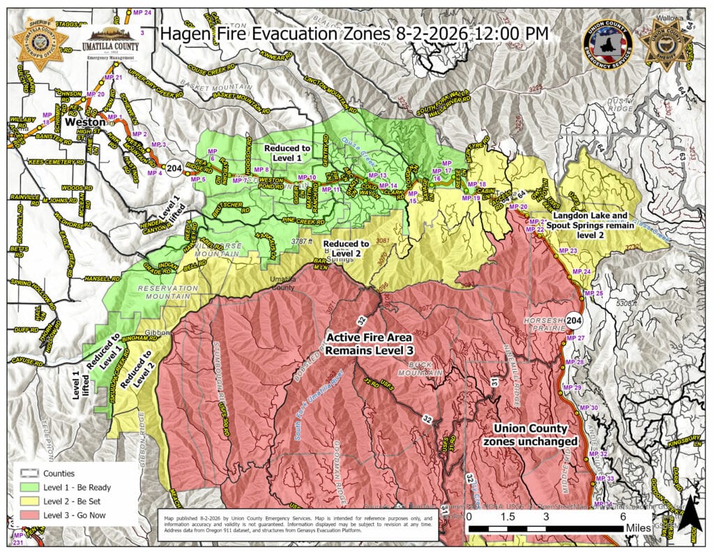
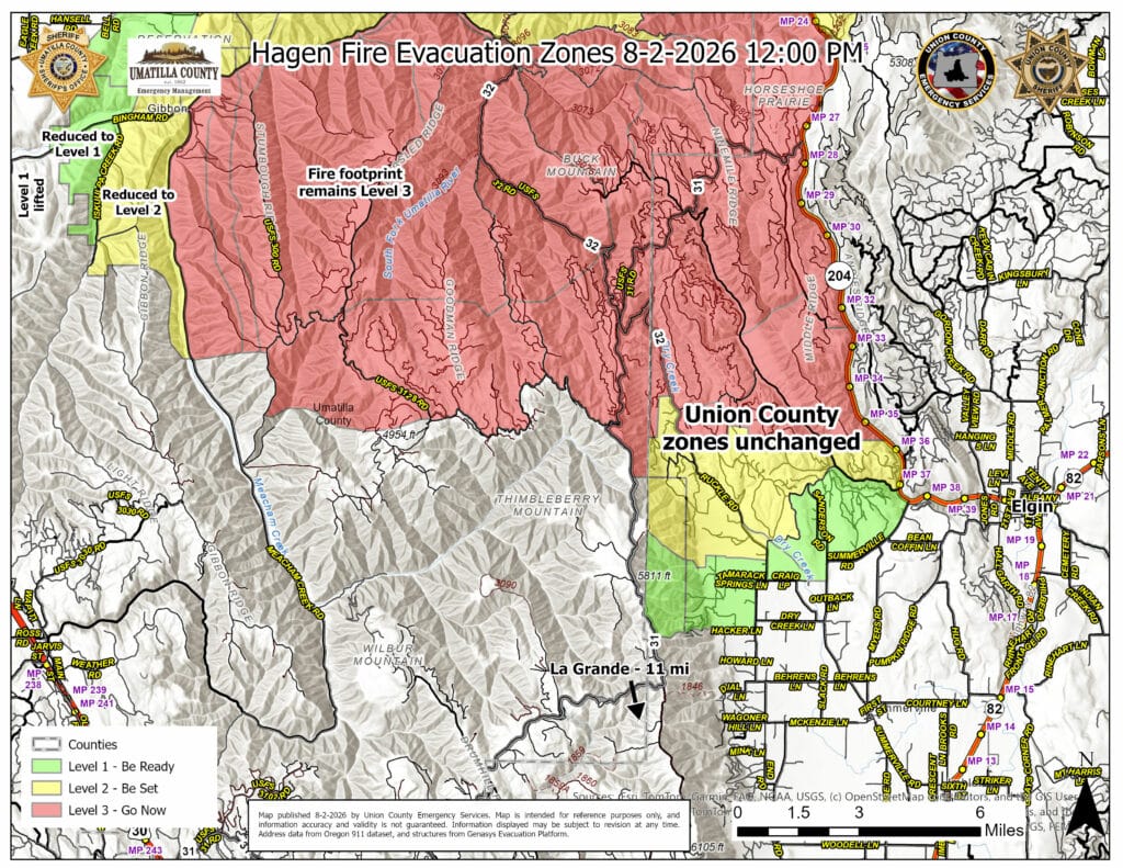
Here are the downgraded levels, per the Umatilla County Sheriff’s Office:
-Previous evacuation levels issued in the area east of Meacham Creek have dropped down one level.
-Previous evacuation levels issued in areas west of McEntyre Road, south along NF 3719 Road and north of the North Fork of the Umatilla River have also dropped down one level.
View the maps below for a detailed view of the evacuation zones. Residents should always check an up-to-date evacuation maps before returning to their homes.
Residents who are returning should be cautious and watch for fire crews and equipment along with smoke, debris, and weakened trees.
A reduction in evacuation level does not automatically reopen closed roads, trails, campgrounds, or restricted area. Check with local officials before going to these areas.
All evacuation levels in Union County remain unchanged.
Officials say the western containment line at Rattlesnake Ridge along with the northern line near Bingham Road held through Saturday’s high winds. Multiple spot fires occurred east of Forest Service Road 31 and those crews worked through the night to contain them, and strengthen FSR 31 as a containment line. They said the fire is holding on the north and west sides, but continues to progress southeast and east along the North Fork of the Umatilla River.
Sheriff’s deputies post evacuation orders last week. Photo from Umatilla County Sheriff’s Office Facebook page.