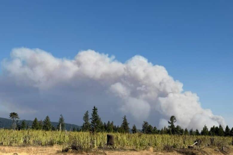
Paradise and Hagen fire updates for Aug 9, 2026
By Garrett Christensen on Sunday, August 9th, 2026 in Columbia Basin News More Top Stories Northeastern Oregon News
UNION, UMATILLA & WALLOWA COUNTIES — (Update from Northern Rockies Team 6) f
Hagen Fire
Latest Intelligence
Size: 46,527 acres
Containment: 11%
758 Personnel
Paradise Fire
Latest Intelligence
Size: 3,155 acres
Containment: 0%
315 Personnel
Key Message – working towards containment
Fire behavior will depend on smoke coverage again on Sunday as the weather enters a slightly more moderate trend. The fire activity will increase in the afternoon if the smoke clears and the sunlight warms the fuels on the ground or if there is wind-slope alignment. The east and south side of both fires are the most active. Crews were able to hold the Hagen fire west of Highway 204 overnight, however it did cross the North Fork of the Umatilla River. Prepping continues along the Highway 204 corridor to prepare for the fire edge which is expected to arrive in the Tollgate area south of the highway today.
Current Status
Paradise Fire – Fire activity was more moderate than anticipated on Saturday and the fire did not reach the wilderness boundary. The fire followed the terrain of the Mill Creek drainage and moved to the east across the upper fork of this creek. Fallers are cutting hazardous trees on the 64 Road while fire managers are scouting for opportunities to tie the southeast side of the fire into the 64 road with fire line. Fire managers expect terrain and smoke dependent fire activity, with heavy smoke slowing fire growth. Firefighters will continue structure assessment and protection in the Biscuit Ridge and Black Snake Ridge areas on Sunday. Walla Walla County has issued a special advisory to alert residents to the presence of firefighting personnel and heavy equipment in the Klicker Mountains area north toward Biscuit Ridge, and east toward the Walla Walla / Columbia County border. See the Walla Walla County Emergency Management Facebook page and webpage for more information. Umatilla and Walla Walla Counties are evaluate evacuation levels daily for areas along Mill Creek and along the west side of the forest boundary. See the evacuation links below for more information.
Hagen Fire – The fire crossed the North Fork of the Umatilla River yesterday. More resources are being shifted to the north of the fire to help manage the spread and focus on structure protection. There were small spots right next to Highway 204, but none was detected the east side of the road on Saturday. Highway 204 remains closed between Weston and Elgin. There was an increase in fire behavior around 2 p.m. with groups of trees torching and places where the fire made small uphill runs. On the west side of the fire, all the slops over the 31 road are being worked, and crews are developing a defensive burning plan to secure the entire fire perimeter on the west side of the 31 Road and to the south of the fire as well. The fire is making its way to the 3128 Road fire line in multiple places. There was a small spot fire over the containment line off the ridge south of the Bingham Road. It was attacked from the air on Saturday and boots on the ground will put in fire line around it and contain it on Sunday. Evacuation levels in Umatilla and Union counties are being evaluated in response to fire now established on the north side of the North Fork of the Umatilla River. See the evacuation links below for more information.
EVACUATIONS
Evacuation Levels: Fire conditions can change rapidly. Evacuation levels are frequently adjusted. For joint updates from Umatilla County, Union County and the Confederated Tribes of the Umatilla Indian Reservation, follow the Umatilla County Sheriff’s Office on Facebook:https://www.facebook.com/UmatillaCountySheriff
For Walla Walla County Emergency Management updates, visit: https://www.facebook.com/WallaWallaEM
or their webpage: www.wwemd.info
Weather and Fire Behavior
Sunday will have more moderate fire weather conditions but still have elevated hot and dry conditions. Today is the start of a trend of moderate cooling and an increase in relative humidity. Winds are expected to be light and the inversion is expected to lift in the late morning which may lead to clear skies. Smoke will be the largest factoring determining fire behavior, more smoke means less fire activity.
Closures and Special Messages
Smoke Outlook: For current smoke reports visit https://fire.airnow.gov. For detailed northeast Oregon air reports, visit https://outlooks.wildlandfiresmoke.net/outlook/61e48530. For southeast Washington, visit https://outlooks.wildlandfiresmoke.net/outlook/bb27fabc
Fire Restrictions: The Umatilla National Forest has issued public use restrictions https://www.fs.usda.gov/r06/umatilla/alerts/phase-c-public-use-restrictions for smoking, off-road travel, and chainsaw use across the entire national forest.
Umatilla National Forest Closures: For public safety and to facilitate firefighting operations:
Hagen Fire: There is a new, expanded closure order for the Hagen Fire:
https://www.fs.usda.gov/r06/umatilla/alerts/hagen-and-horse-ridge-fire-emergency-closure
And https://www.fs.usda.gov/r06/umatilla/alerts/hagen-fire-expanded-emergency-closure.
Areas included in the closure include: Corporation Guard Station and Trailhead, North Fork Umatilla Trailhead, Umatilla Fork Day-Use Area and Campground, Buck Creek Cabin, Buck Creek Trailhead, Horseshoe Prairie Trailhead, Woodland Campground, Lugar/Eagle Springs Trailhead, and the Jubilee Lake area. This is not an exhaustive list.
Paradise Fire: The Paradise Fire closure order and map are available at
https://www.fs.usda.gov/r06/umatilla/alerts/paradise-fire-emergency-closure.
Areas include the Mill Creek Watershed, FSR 64 from its junction with FSR 46 to its junction with FSR 65 and FSR 65
Air Space Restrictions: Temporary Flight Restrictions are in place over the wildfires. If you fly, we can’t. Every time a drone is spotted near the fire all aircraft are grounded until we can be sure the drone is clear of this area. http://knowbeforeyoufly.org