Evacuation levels reduced for Lower Dry Creek Fire
By Griffin Beach on Thursday, July 16th, 2026 in Columbia Basin News More Top Stories
WESTON – UPDATE: 07/16/2026 (From the Umatilla County Sheriff’s Office) AT 7:24 p.m. EVACUATION LEVELS REDUCED on LOWER DRY CREEK FIRE
The Umatilla County Sheriff’s Office has reduced some evacuation zones on the Lower Dry Creek Fire. The current evacuation zones are:
LEVEL 3 (GO NOW!)
UMC-071-E: East of Pine Creek and south of Lower Dry Creek Road.
UMC-071-F and UMC-071-B: West of Highway 11, including Steen Road and York Road north of Highway 11.
UMC-117-C: Includes the Highway 204 and Steen Road area.
UMC-117-D: Includes Couse Creek Road.
UMC-117-E: North and east of Highway 11.
UMC-075-B, UMC-075-A and UMC-123: North of Basket Mountain Road, including South Fork Walla Walla River Road and Lincton Mountain Road.
UMC-077-A: Includes Walla Walla River Road and forms the northern boundary.
UMC-075-C: Includes Coe Road and Cache Hollow Road.
LEVEL 2 (BE SET):
Zones UMC-151-C, UMC-151-A, and WEW-115
The area north of Wildhorse Road, south of Highway 204, east of Schrimpf Road and DeGraw Road, and west of Weston Mountain.
LEVEL 2 (BE SET):
Zones MIF-073-A
The area west of Couse Creek, east of Highway 11, south of Sykes Boulevard, and north of Alderbanks Vineyard.
Residents in these areas, while able to return home, should remain aware of ongoing fire operations and use caution around emergency personnel and equipment.
****
PREVIOUS:
As of Thursday morning a large area remains under a Level 3, Go Now evacuation for the Lower Dry Creek Road fire which began burning on Wednesday.
The latest evacuations from the Umatilla County Sheriff’s Office:
UPDATE: 07/15/2026 AT 9:20 p.m. **EVACUATION LEVELS INCREASED for LOWER DRY CREEK FIRE
LEVEL 3 EVACUATION (GO NOW) City of Weston, from Schrimpf Rd to Kirk Rd and Kee’s Cemetery Rd to Highway 204.
LEVEL 3 EVACUATION (GO NOW) Highway 204 to Basket Mountain Rd and Highway 11 to Kirk Rd
LEVEL 3 EVACUATION (GO NOW) North of Wildhorse Rd, South of Highway 204, east of Wildhorse Rd and west of Lupine Lane
LEVEL 3 EVACUATION (GO NOW) North of Couse Creek Rd, South of Walla Walla River, East of Highway 11 and West of Foster Rd area.
LEVEL 2 EVACUATION (BE SET) NE of Highway 204 to Basket Mountain Rd between Kirk Rd and Hodgens Rd.
LEVEL 3 EVACUATION (GO NOW) North of Couse Creek Rd, South of Walla Walla River, East of Highway 11 and West of Foster Rd area.
LEVEL 3 EVACUATION (GO NOW) Walla Walla River Rd and Couse Creek to Harris Park and Walla Walla Walla River Rd along Lincton Mountain Rd till about 5 miles north of Highway 204. (Including Harris Park)
Sundridge Middle School in Pendleton and the Milton-Freewater Community Building are open for evacuees
Oregon Highway 11 and Oregon Highway 204 have both reopened after they were closed for much of the evening due to the fire.
The fire has also disrupted local utilities. Pacific Power officials confirmed they have deenergized lines in the Weston area. Outage maps from Pacific Power and Umatilla Electric Cooperative indicate that remaining power outages on Thursday morning are largely confined to active wildfire zones.
Wtechlink said the fire burned up some of their fiber lines affecting customers in Milton-Freewater. Spectrum is also reporting outages in the Pendleton area but did not confirm if the fire was related.
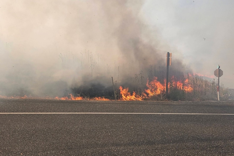
Photo from East Umatilla Fire and Rescue