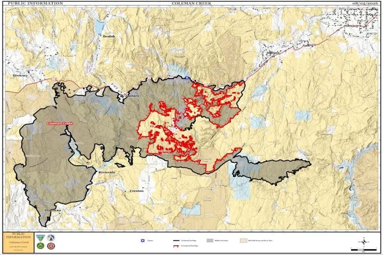
Coleman Creek Fire incident update as of August 5, 2026
By Mindy McKerrall on Wednesday, August 5th, 2026 in Eastern/Southeast Oregon News Eastern/Southeast Oregon Top Stories
HARNEY AND MALHEUR COUNTY-
Location: Burns Basin, Start Date: July 25, 2026, Size: 278,128 acres, Containment 32%, Cause: Natural/Lightning, Personnel: 400.
The priority for the Coleman Creek fire continues to be securing and strengthening containment lines while identifying and extinguishing remaining hotspots within the fire perimeter. Firefighters continue patrol and mop-up operations along Highway 20 and in the Drinkwater Pass area. Firefighters continue suppression efforts by locating and extinguishing hotspots throughout the Wildcat Creek, Alder Creek, and surrounding drainages along the eastern and southern edges. Road grading operations started in the Yapaa Creek area to improve access for firefighting resources and to repair damage made by large equipment.
Firefighters completed constructing fire line on the north edge of the eastern portion of the fire towards Lake Owyhee and continue fire line construction along the southern portion of this section. Firefighters are being supported by aircraft when needed. Initial attack resources will be available to support the local area.
WEATHER: Near Critical Fire Weather Conditions persist through the week. Daytime temperatures will
increase later this week into the high 90s. Minimum RH values will also decrease sharply towards the single digits. Fire managers anticipate West/Northwest winds for the western flank of the fire and North/Northeast winds for the eastern flank. Terrain will influence winds throughout the forecast period.
EVACUATIONS: An upgraded evacuation order was issued in Malheur County yesterday on the eastern side of the fire. There are existing evacuations and warnings that also remain in effect. For an interactive map of evacuations, visit: Genasys Protect.