Bases set up as wildfires surge across Oregon-Washington border
By Dan Thesman on Monday, July 20th, 2026 in Columbia Basin News More Top Stories
Persistent high temperatures, low humidity, and gusty winds continue to fuel lightning-caused wildfires across steep terrain in northeastern Oregon and southeastern Washington, forcing elevated evacuation levels for local communities.
More than 200 firefighters using full suppression strategies are managing several widely separated blazes in inaccessible regions. Northwest Team 7 has established incident command bases in Walla Walla and Athena, to direct emergency operations and protect nearby structures, watersheds, and timberlands.
Officials reported the following fire updates, ordered from largest to smallest by acreage:
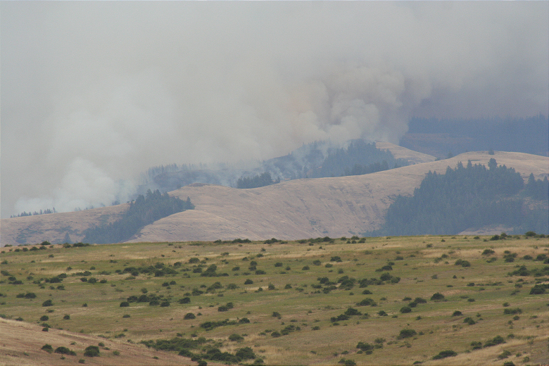
- Hagen Fire: The largest of the blazes spans an estimated 3,794 acres roughly 9 miles southwest of Tollgate, with zero percent containment reported. Umatilla County with Confederated Tribes of the Umatilla Indian Reservation has issued evacuations for the Hagen Fire that include Level 3 (GO NOW!) and Level 2 (BE SET) and Level 1 (BE READY) for affected areas. Follow the Sheriff’s Office on Facebook for evacuation updates: https://www.facebook.com/UmatillaCountySheriff .
- Horse Ridge Fire: Located about 5 miles northeast of Meacham, this fire covers an estimated 557 acres and is 10 percent contained. Fire crews are executing burnouts along the 050 Road to reinforce containment lines.
- Paradise Fire: Covering an estimated 453 acres roughly 10 miles southeast of Walla Walla, this blaze is exhibiting moderate activity with no containment announced. Crews are preparing roads for fire traffic while using aerial water drops to slow its spread.
- Ninemile Fire: Burning an estimated 19 acres inside the North Fork Umatilla Wilderness about 4 miles southwest of Tollgate, this uncontained fire has shown minimal activity over the last 24 hours.
Officials expect fire activity to peak during late afternoon and evening hours as downslope winds pick up across the region.
Photo of the Hagen Fire take July 19, 2026, by Dan Thesman