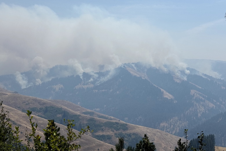
Level 3 “Go Now” evacuations ordered for Hagen Fire in Umatilla County
By Dan Thesman on Sunday, July 19th, 2026 in Columbia Basin News More Top Stories
UMATILLA COUNTY — Emergency managers and tribal officials issued immediate, tiered evacuation orders for portions of northeastern Oregon on Sunday as the Hagen Fire continued to threaten rural communities across rugged terrain.
The joint announcement from the Umatilla County Sheriff’s Office, the Umatilla County Emergency Operation Center, and the Confederated Tribes of the Umatilla Indian Reservation (CTUIR) warns that steep geography and heavy timber are creating unpredictable fire movement and potential communication delays.
Evacuation Status Breakdown
Authorities have established three distinct alert tiers depending on proximity to the flames:
- Level 3 (“GO NOW!”) — Immediate Danger: Residents along Bingham Road, the Umatilla River Corridor, and the Hagen Creek area must evacuate immediately.
- Level 2 (“BE SET”) — High Readiness: Covers Bingham Road from the CTUIR boundary to Meacham Creek, as well as areas south of Wildhorse Road between Reed Road and Hawley Road, stretching east to the intersection of Abel Road and Bell Road (Zones UMC 149-C, 149-B, 215-D, 1406015-D, 1406015-C, and 1406015-A). Residents must be ready to leave at a moment’s notice. Those with livestock, mobility challenges, or extra transport needs are strongly urged to leave now.
- Level 1 (“BE READY”) — Awareness: Extends from the intersection of Wildhorse Road and Abel Road north to Highway 204, and east to National Forest Road 37-15, including all areas north of Wildhorse Mountain and Grouse Mountain. Residents in these ten designated zones (UMC 151-F, 151-H, 151-G, 151-D, 155-A, 155-B, 157, 215-A, 215-E, and 1406007-B) should monitor conditions and prepare essential items.
Severe Terrain and Access Risks
Officials cautioned that the region’s geography presents serious hazards that could complicate evacuations if conditions deteriorate rapidly:
Narrow Ingress/Egress: Roadways offer limited space for vehicle turnarounds and emergency equipment.
Limited Escape Routes: Very few alternative roads exist if primary corridors are cut off by flames.
Dense Fuel Loads: Heavy timber and thick brush are driving rapid fire acceleration.
Alert Delays: Spotty cellular service in deep canyons may delay emergency broadcast notifications.
Emergency personnel are advising residents not to wait for direct notification if they feel endangered or see approaching smoke and flame. Vehicles should be parked facing outward toward exit routes, fueled, and packed with necessities.
Updated evacuation boundaries and real-time mapping for the Hagen Fire, alongside the nearby Paradise and Horse Ridge fires, are being maintained on the Umatilla County Emergency Advisories online portal.